I want to go from point A to point B avoiding climbs, but also take the shortest route possible with the fewest climbs. Does any mobile app exist that can find the shortest route and with the lowest sum-total amount of elevation change between two places?
-
1Conflicting requirements. Minimum distance between two points will have the maximum slope.– paparazzoCommented May 15, 2015 at 16:36
-
1Perhaps it's not maximum slope that's concerning but rather the sum of any required climbs?– RossCommented May 15, 2015 at 17:30
-
1yes @Ross the priority is the minimum slop– dimitCommented May 15, 2015 at 18:07
-
1Minimum slope(grad) is not the same as sum of any required climbs. There is only one shortest route between two points. You cannot have shortest route and anything else.– paparazzoCommented May 15, 2015 at 18:39
-
1its ok , as you can see my english is very poor– dimitCommented May 15, 2015 at 19:18
2 Answers
Strava has this feature in the route planning tool.
In the header, you can see it has toggle switches for popularity (pretty nifty if the area is new to you), min-elevation (what you're looking for), and manual.

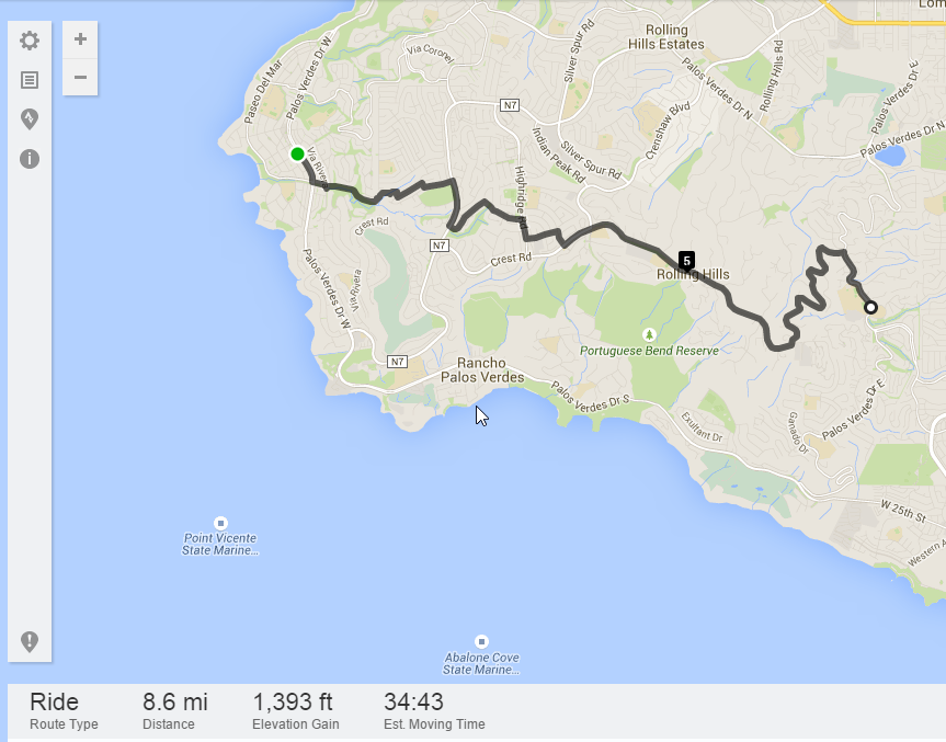
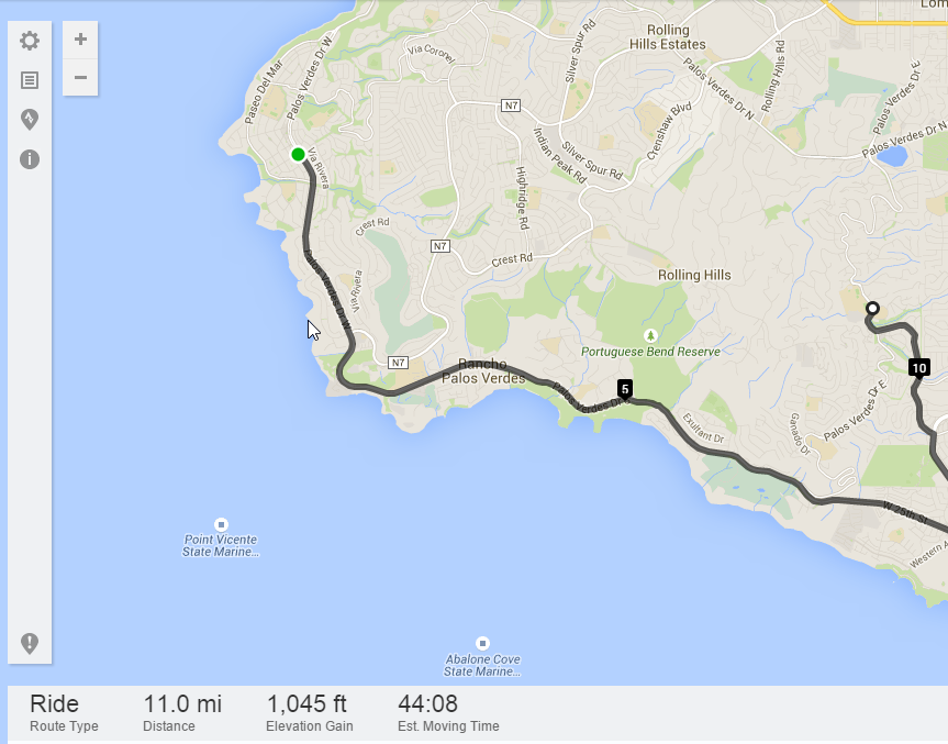
Here is an example of how it works. The below route is between two points in Palos Verde, CA - a notoriously hilly (fun) area.
Min Elevation OFF:

Min Elevation ON: Here's the route with the same end points and the feature turned on -- a savings of 348 feet of elevation gain, but an extra 2.5 miles of riding.

Google maps has a bike route feature that displays elevation and tries to find the least-steep and most bike-friendly path between points by default.
- Go to Google Maps at http://maps.google.com.
- Select Directions.
- Type your starting address.
- Type your destination.
- Click "..." to the left of the Directions icon, then click the bicycling icon.
- Customize the route by dragging the blue line (your bike route) wherever
-
I am in Greece and here i can't get bike directions with google maps.– dimitCommented May 15, 2015 at 18:44
-
Several possible alternatives may be listed here: bicycles.stackexchange.com/questions/154/…– digijimCommented May 15, 2015 at 18:50
-
Interesting answer, I wasn't aware that Google published their "default" metrics (such as minimising climbs). Do you have any more info?– PeteHCommented May 15, 2015 at 21:07
-
Found this relatively thorough explanation of all the factors that go into determining the 'ideal' route: google-latlong.blogspot.com/2010/03/its-time-to-bike.html Granted, it is 5 years old, but it's also posted by a Google engineer from the Directions team.– digijimCommented May 15, 2015 at 21:18
-
Great start, and has to be targeted at an average person, but everyone is different - I am a strong climber and relatively weak on the flat, so do better on hills than my peers. Others hate hills and would double the distance to avoid a climb. In the end a route calculator would need to provide choices for the user to select from.– mattnzCommented May 15, 2015 at 23:09
