0

Is there a list/site out there that contains roads and pavement conditions?

I ride a road bike and some NYC roads are really beaten up, while some maintain reasonably smooth pavement. It would be awesome to have a list of these and to know what to take/avoid.

Failing that, are there any resources in NYC that will tell me where construction is scheduled or happening? At least I could avoid those areas.

6
  • 1
    A list of what roads are good might be better than a list of roads that are bad. While it doesn't address asphalt conditions, the New York City Cycling Map documents the city's extensive network of bike lanes and offroad bike paths. Roads that have bike lanes at least (in theory) will have more room to dodge potholes. Commented Jul 27, 2011 at 0:10
  • 1
    Also, the Broadway bike lane in Manhattan is awesome. Take it when you can, even if it's a little bit out of the way. Commented Jul 27, 2011 at 0:14
  • Locally produced bike maps are definitely the place to find that kind of information. Seattle has an excellent one.
    – zenbike
    Commented Jul 27, 2011 at 9:21
  • 1
    In Toronto there's a number you can phone (or a web site) to report a pot-hole: they fill it almost immediately, and tell you when they've done it: a very user-friendly system.
    – ChrisW
    Commented Jul 28, 2011 at 2:37
  • 1
    I added the last paragraph, since this question hasn't gotten any answers yet. Is that in keeping with what you're looking for? (Please delete my text if it's not appropriate.) Commented Aug 1, 2011 at 0:04

1 Answer 1

2

While New York City is at the moment quite bike-friendly, potholes, cracks, and patched roads are still problems. Unfortunately, there seems to be no single resource for finding smooth roads in the city. The best you can do may be to rely on information from several sources, and use your own experience to decide on how to use the information.

Google Maps Traffic

Google Maps has a layer for traffic, and that shows ongoing road work. For example, this view of Manhattan has icons for road closures due to construction and other maintenance work to bridges and tunnels.
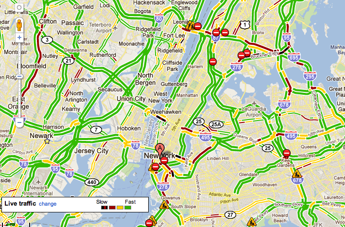
Google Maps traffic layer, view of Manhattan

While this won't tell you what areas simply have bad pavement, avoiding these areas will at the least help matters.

NYC Bike Map

The impressive NYC Bike Map will help keep you to areas that are more suitable for cycling. However, from experience, I can tell you that not all of these have suitable pavement for skinny tires. (For example, the East Side Greenway is shown in green, and while it's quite rideable, the surface isn't the best and the path has many corners and even a staircase. At least, this was the case a year or two ago, the last time I rode it.)
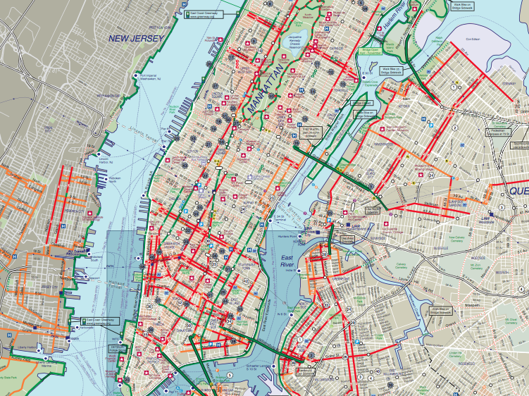
NYC Bike Map sample

The map also exists as a Google Maps/Google Earth layer, although whether it's current or not is another matter.

Conclusion

In summary, riding the roads and learning them well is probably the best way to know where to ride. I suggest using these tools to get some information to guide where you ride until you learn the roads. You can also ask bike clubs and bike shops for further advice.

Your Answer

By clicking “Post Your Answer”, you agree to our terms of service and acknowledge you have read our privacy policy.

Not the answer you're looking for? Browse other questions tagged or ask your own question.