V1 is "Velocity 1 Pacific Motorway" which is a dedicated cycleway running between Lower River Terrace, South Brisbane and Eight Mile Plains. The 17km cycleway provides a safe and efficient route for people travelling by bike.
source: https://www.tmr.qld.gov.au/projects/Veloway-1-Pacific-Motorway
It is incomplete as of posting, with work progressing. The parts that are done look functional, not exactly scenic or healthy when hard-beside the motorway.
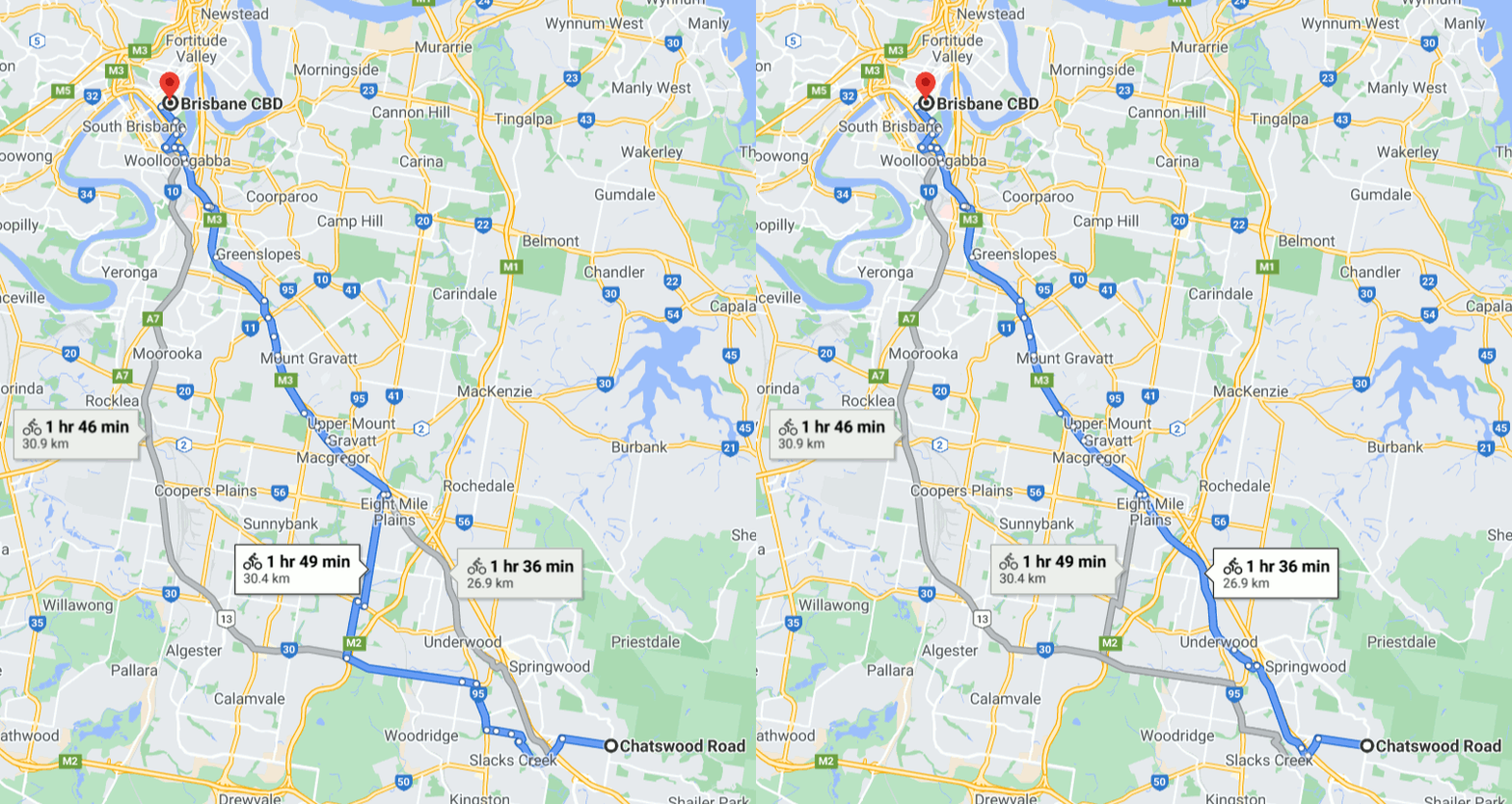
I couldn't find a good map for the path, so assuming a start point in the middle of Daisy Hill, working with google maps suggests these two dreadful routes:
26.9 km straight up Logan Road to the "start" of V1
30.4 km doing a dogleg along Compton Rd and then north on Persse Rd. Compton is a 70 km/h dual carriage way with no shoulder and Persse is narrow too. Not recommended

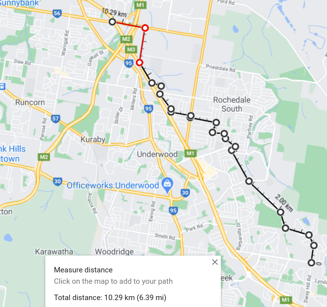
So here's two routes for starters.
- Starting at Daisy Hill Road and Chatswood Road (its where "Daisy Hill" label shows )
- Head North on Daisy Hill Road
- Follow onto Springwood Road
- Turn right onto a series of residential side roads
- Elysium Road
- Minerva Street
- North onto Donna Ave then Sultan St
- West onto Greenview Ave
- Do a right onto 30 then immediate left into Roseland Ave
- Right into Anna Marie St
- Left into Rothon Drive
- Then I'd cross into School Road and push hard all the way to Miles Platting Rd, and then turn left onto 56. this is the worst part and frankly it looks awful.
- Finally you're at the V1 and from there it looks okay from there onward.

** This route starts okay, but at the end there is a long stretch of badness. The advantage is its more direct and 3 km shorter. **
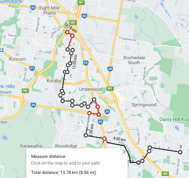
Route #2
- West on Chatswood
- Southwest on Paradise Rd - the footpath here is marked as shared use, so use it
- Turn into the Slacks Creek Corridor which goes NW through Ken May Memorial Park.
- West on Reserve Road
- North on Kingston to Smith Street
- West on Smith Street to Ewing
- North on Ewing to Compton
- East on Compton, then North on 95 for a total of 1.25 km of awful
- Left onto pathway
- Brookvale Drive
- pathway
- North on Pioneer Drive
- North on Stiller Drive
- Left into Underwood
- North on Levington
- then ride the hard shoulder on 95 again until you get to start of the V1 at intersection of "Gateway Motorway" and 95.

This route is more windy and has three separate pieces of badness, (curiously all on different pieces of 95) while also including several pathways which may be paved or unpaved. Its also longer
Lastly if it was me, I'd be tempted to put several daytime rear lights on the bike, and blatt up 95 all the way to the start of V1. I'd also ride with a rear-view mirror to keep an eye on what's coming up from behind, and I'd also be turning my head to look back frequently and make eye contact with things coming up behind.
Aside, I did locate "the world's most confusing bike path" at
which may be relevant.
Finally - consider getting involved in Advocacy to ensure that V1's later stages don't slip or get cancelled. This doens't mean street protests and placards, but writing supportive letters to the council and to Queensland Department of Transport and Main Roads would certainly help.


