7

I mostly commute and have never had trouble climbing a hill sometimes by using my lowest speeds (or close to them).

How do I evaluate even roughly what grave %age I climbed?

What I mean is that I would love to tour someday in a real mountain-y region, and would like to know how to approach climbs like this.

For example, I see profiles with %ages as high as 10%. I know I never rode 10km at 10% but how does 10% look like? how do I know I won't be forced to give up after the first mile or two?

How about 5%? 7%? or the extreme 12.5% I see on some climbs?

I do have a GPS device that gives a reliable path of where I've ridden, but the altitude is not reliable to the profiles of my rides are not either.

1

3 Answers 3

7

There are various web sites that might help.

I use one called http://ridewithgps.com. You need to register on it but you can get quite a lot from a free account.

Does your GPS device output GPX files? If so, I think Ride With GPS can suck them in. If not you might have to put your route into the site manually (but this is easy enough).

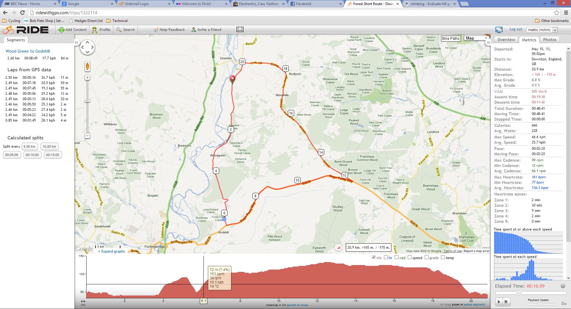
But what you do get on your route is a display of the gradient (you hover over different parts of the route to see it).

For example, I did a quick ride yesterday afternoon, here it is:

RideWithGps screenshot

I have a pay account with these people but I'm fairly sure you get this page with the free account too.

Any good to you?

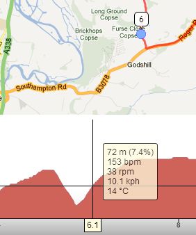
Just added another image - didn't realise SE was going to reduce the main one so much. This is just a zoom of the bit with the tooltip. Note also the blue dot in the corner - this is the location on the google map which corresponds to the crosshairs on the elevation plot.

RideWithGpsZoom

12
  • 2
    Strava is another popular site that you can upload your GPX file too. They offer quite a bit for free but also have some advanced features for those willing to pay for a membership.
    – Kibbee
    Commented May 16, 2013 at 18:15
  • @Kibbee do you use Strava? do you like it? I was pointed to it by someone but what he said gave me the impression that it was mainly used to race against your mates. That put me off a bit.
    – PeteH
    Commented May 16, 2013 at 18:22
  • 1
    I do use Strava and like it. They do kind of put an emphasis on comparing you against others, which can be both fun, if not a little demoralizing. They break up your ride into different sections that allow you to see how your time compares to others who have done the same climb. You can just ignore the standings if you want.
    – Kibbee
    Commented May 16, 2013 at 18:32
  • 1
    MapMyRide is a good resource as well. You just need to create a free account in order to create routes.
    – sevargdcg
    Commented May 16, 2013 at 18:34
  • 1
    I use Strava a lot and agree with what @Kibbee says about the emphasis on comparing to others, but within these 'leader boards' you can select to just show just your rides on each segment to see how you have improved over time. Additionally, you can change your default view settings to default the leader board to All, people you follow, or even a club. If you don't follow anyone, you can set the default view to basically show no one else but your ride time for each segment. Commented May 16, 2013 at 19:07
5

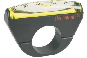
Get a Sky Mounti inclinometer:

enter image description here

Not terribly accurate, and not much use on rough pavement, but it gives you an immediate readout that doesn't "smooth over" the ups and downs the way that maps will.

(I should state that it has a problem on level ground -- the faster you go (especially on rough pavement) the higher it reads. But get on a grade over 4-5% and it seems to be fairly stable & reproducible.)

4
  • The only way I could get this (relatively pricey) thing to work was to stop my bike. I'd recommend a GPS gizmo instead.
    – Ken Hiatt
    Commented May 16, 2013 at 22:38
  • Mine works fairly well. Not on rough pavement, as I said, but otherwise OK. Commented May 17, 2013 at 0:02
  • had to look it up, $20 on amazon. Is that oil inside? You could imagine you'd want something a little (but not too) viscous to negate jitter.
    – PeteH
    Commented May 17, 2013 at 5:46
  • It's some sort of mildly viscous fluid, similar to the stuff in carpenter levels. Survives freezing weather just fine. Commented May 17, 2013 at 11:33
0

I use a Garmin Edge500. I upload to the Garmin website, and the site shows a gradient map of the ride, among other things. The grade and altitude measures do have some error. But I can also monitor this during the ride and get a better idea of what various grades feel like.

As an example of inaccuracy, a bunch of us who did the Santa Fe century on Sunday reported total climbing figures between 4700 and 5700 feet but clustering around 5300. Maximum measured grade was 16% on the agonizing Heartbreak Hill, which seemed endless.

Your gearing will probably make more of a difference than your slope measures. If in doubt, get the biggest freewheel cluster your derailleur will handle.

Your Answer

By clicking “Post Your Answer”, you agree to our terms of service and acknowledge you have read our privacy policy.

Not the answer you're looking for? Browse other questions tagged or ask your own question.