19

Where are the best places to find bike maps with local routes and trails?

Places I typically reference when searching for this includes:

  1. Most local bike shops (LBS) have local maps available or for sale.
  2. Employees of any LBS are often avid riders and will hold a plethora of knowledge about the local area and trails.
  3. Local trail clubs (typically volunteers that help maintain trails in an area) can be a resource to direct you to finding maps or trail information.
  4. Your local Chamber of Commerce or Parks & Rec type of department will typically have maps of local bike routes.
  5. Google Maps has recently introduced the ability to find directions from one place to another by bike. For certain metro areas they will route you along known bike routes or trails. When doing directions click on the "Bike" icon to tailor it specifically for bikes.

Please feel free to add more.

2
  • 1
    try looking close where you are....
    – Ian
    Commented Sep 10, 2010 at 21:01
  • Google maps doesn't include a Cycling option in the UK.
    – Amos
    Commented Sep 10, 2010 at 23:21

13 Answers 13

15

You can use google maps, and click on the bike to see local bike paths and trails. (Still in beta but very good nonetheless.)

are some of the more popular routing sites, I'm sure there are more but that should get you started :)

The following sites are now defunct but preserved by the Internet Archive:

2
  • 6
    I've had some issues with Google's bicycle routes putting me on sections of road that are unsuitable (broken chunks of pavement) when there are nearby but lesser known alternate routes, so caveat emptor. Commented Aug 25, 2010 at 22:57
  • 1
    Google Maps gave me a route that included a dirt path, which would be okay if I was riding a mountain bike, but my 700x32's didn't like the dirt... I just stayed on the county roads...
    – gnarf
    Commented Aug 25, 2010 at 23:26
8

OpenCycleMap, based on OpenStreetMap, is another resource you might consider. It uses a Creative Commons Attribution-Share Alike license, which is why many of the mobile applications actually use the OpenCycleMap data. Anyone can register and contribute to OpenCycleMap, so in that sense it is like Wikipedia, in that it is often more up-to-date. Just looking at OpenCycleMap is much easier than a Google Map for instance, because the cycle routes are clearly marked.
www.skobbler.us is useful as an app on a smart phone. It does not only provide car routes but also for bike and pedestrian. But both are basically maps, not so much suggestions where to ride.

1
  • You get the exact same map as OpenCycleMap if you go to openstreetmap and select Cycle Map
    – gerrit
    Commented May 8 at 8:53
5

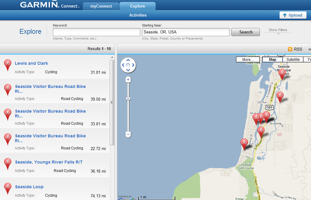
Go to https://connect.garmin.com, and click on the "Explore" link. Type in the region that you're interested in, and you'll see bike routes that others have ridden on. It's a great way to find new routes and there's very detailed GPS data (and elevation profiles!) available for each one of those routes.

Here's an example of routes that I found for my vacation in Seaside, OR earlier this year.

screenshot of Garmin Connect

4

Ride with GPS is my current fave and keeps getting better.

Here are the features:

  • Draw routes on a map before you ride, then download to your GPS unit for turn-by-turn directions
  • See elevation profile as you draw, so you know how difficult the ride will be before you head out
  • No sign-up required, no GPS required

In my area there are a lot of user contributed routes, but may not be the case everywhere.

4
  • 1
    Drawing routes for uploading isn't really good because you can't use it as a virtual partner. A much better alternative for this kind of thing is bikeroutetoaster.com. You can set few parameters and to my opinion its calculated virtual partner timing is very good except for descends where you normally gain some advantage (which is a confidence booster anyway) Commented Mar 23, 2011 at 9:02
  • @Robert - bikeroutetoaster looks pretty cool. After taking a look not sure what you mean about "virtual partner". Do I need to register on the site to see that function? Also, I've found ridewithgps to be quite suitable for planning out local bike routes.
    – user313
    Commented Mar 23, 2011 at 21:07
  • virtual partner is a function on Garmin units that shows you how you're doing compared to your partner (how much are you ahead/behind in terms of distance/time). You can compete against previous activities you've done (compete against yourself) or you can upload others and compete against those. bikerouteoaster.com is especially great at creating your own virtual partner activities to compete against. No signup required. Commented Mar 24, 2011 at 8:38
  • 1
    There are two major parameters: avg speed and climbing speed. Based on these two it calculates your route. You're fast on flats and it slows down on climbs based to steepness. That's why I love it. Commented Sep 5, 2011 at 12:25
2

I can see that nobody has yet mentioned http://www.bikeroutetoaster.com which I use for route creation before I head out on an unknown territory.

Slowdown uphill calculation based on steepness

The best thing about it is that you can set few parameters (defaults are quite fine for advanced recreation) and it calculates timing based on these parameters which turn out to be quite good. You can then upload it to your GPS unit (ie. GARMIN EDGE 500) and use it as your virtual partner.

You can also set track points, so your unit can tell you when and where to turn (you can do that easily on a map because you see roads). I'm using GARMIN EDGE 500 which doesn't have maps so these turns on unknown roads are great. I can focus more on my ride than finding my way on unknown village roads.

The only downside to it is that it doesn't calculate descends. It uses your flat speed for that, because descends are tricky. So you gain a bit over your virtual partner on descends. But if nothing else that's a nice confidence booster for you.

So I use:

  1. http://connect.garmin.com for uploading data
  2. http://www.ridewithgps.com for better section analysis
  3. http://www.bikeroutetoaster.com for great pre-ride routing capabilities

If anyone knows of an alternative to bikeroutetoaster.com I'd be interested to hear about it.

1

Runkeeper.com can have some routes but the only ones I find for my area is the ones I've added.

http://www.mapmyride.com/ is another good resource. Those are the ones I use.

1

Some cities also have a Google Maps layer for bike routes. When punching in source and destination address, there will be a little bike icon if it's available. Haven't tried it out, so have no idea how accurate it is, but it might be worth a shot.

1

Strava.com and mapmyride.com are particularly nice for finding routes. They also categorize the climbs (from #5 to Hors) as documentation for bragging rights. Both have smartphone apps. Mapmyride has a slightly better UI (IMO), but strava has more users/rides (at least in the areas I am interested in).

One interesting thing you can do on strava for giggles is to check out what the pros do on their rides: Like this!

Bikely used to be the best, but they have problems with uptime and lag (the server is in GB).

1

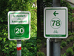
In Belgium and The Netherlands there exists a "Fietsroutenetwerk" (Bicycle route network). This is great for planning road trips. Short and longer ones.

Alongside save and good cycling roads, there are simple signs with numbers that point to the next node in the network. At nodes, there are signs to connected nodes.

Signs

The idea is, that you plan your own route, but you need to know the numbers of the nodes. There are websites and plans that can help you with your planning (Example).

At home you make a list of node's to follow, like (14 - 15 - 16 - 14), and you can simply follow the signs.

Nodes are not connected with the shortest route, but with nice and safe bike routes.

There's over 20.000 km documented, and connected routes.

1
  • Besides there are several kinds of sign posted routes and quite a few that are not sign posted. Your best bet finding one of those or one that used the nodal network from the post it searching for -fietsroute- and country or cycle tour and country.
    – Willeke
    Commented Aug 5, 2015 at 16:54
0

I'm rather fond of Everytrail. You can find maps for just about any activity, not just biking, though that's what I primarily use it for. There are iPhone and Android apps too, which work really well. They just added the ability to search for trails based on your current location (in the Android version at least), filterable by activity (road biking, mountain biking, etc). I've found a bunch of new places to check out this way.

0

Transport Direct have a route planner which includes cycling routes and has some nice options (especially the choice between quietest, quickest and most recreational route).

CycleGM have details of all cycle lanes and traffic free routes through Greater Manchester on their website, but the online map is not very user friendly.

0

I mostly use Wikiloc. You can find routes for different activities, visualize them in Google maps, open them in Google Earth and load them into your GPS.

0

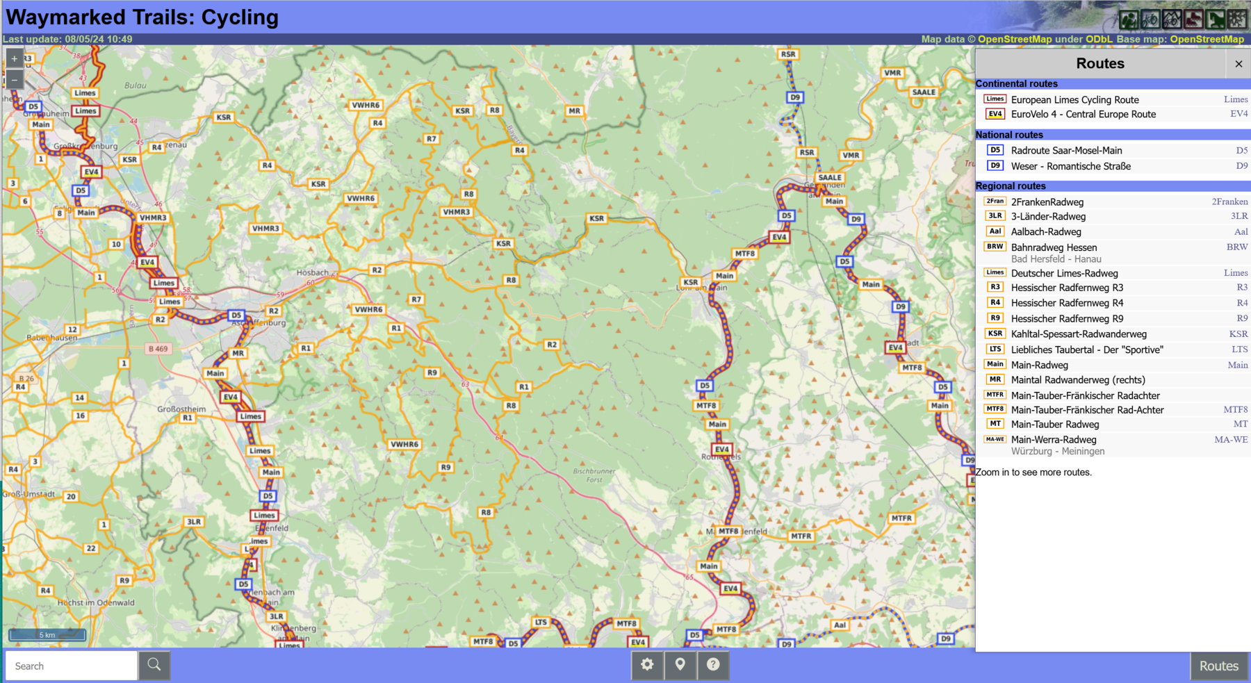
For waymarked routes, I like to use https://cycling.waymarkedtrails.org:

Screenshot waymarkedtrails

The routes are based on Openstreetmap, as is the background map. As you zoom in and out, it shows on the right the routes in the field of view sorted by length. By clicking on the route, you can download a GPX to load into your navigational device for offline use. Apart from bicycle touring, waymarkedtrails also supports hiking, mountain-biking, inline-skating, horse riding, and winter sport slopes.

Limitation: unlike opencyclemap, proposed routes are not shown, only final routes (which makes sense, since I would expect proposed routes not to be waymarked).

Your Answer

By clicking “Post Your Answer”, you agree to our terms of service and acknowledge you have read our privacy policy.

Not the answer you're looking for? Browse other questions tagged or ask your own question.